")

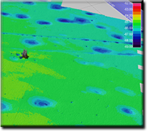
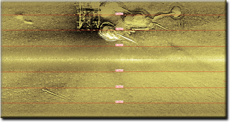
| Geophysical data provides vital information on the geology of the sub-bottom strata, required for any engineering, construction, drilling, and production and mining activity. Detailed geophysical surveys and assessments of the seabed and sub-seabed plays a decisive factor in reducing the risks and make them cost-effective design of marine structures and subsea installations. Geophysical site survey is often conducted when a jack-up rig wants to approach to the platform and this operation ensures the client about seabed obstructions and geology of the seabed. What are we trying to find out through a geophysical site survey? |
||
 |
Water depth, seabed relief, seabed gradients | |
|
Obstructions, debris, wrecks, existing installations | |
|
Seabed sediment types | |
|
Shallow water geology, foundation conditions, trenching conditions | |
|
Geo-hazards such as shallow gas | |
| The results of site survey operation include: | ||
 |
Bathymetry charts in the site location | |
|
Seabed feature charts (which shows the location of obstruction on the seabed) | |
| The results of geophysical site survey are shown in the following reports and charts: | ||
|
Final text reports “Geophysical site survey report”. | |
|
Charts | |
|
Bathymetric charts that all of depths reduced to LAT | |
|
Seabed feature. | |
|
|
||
 |
||